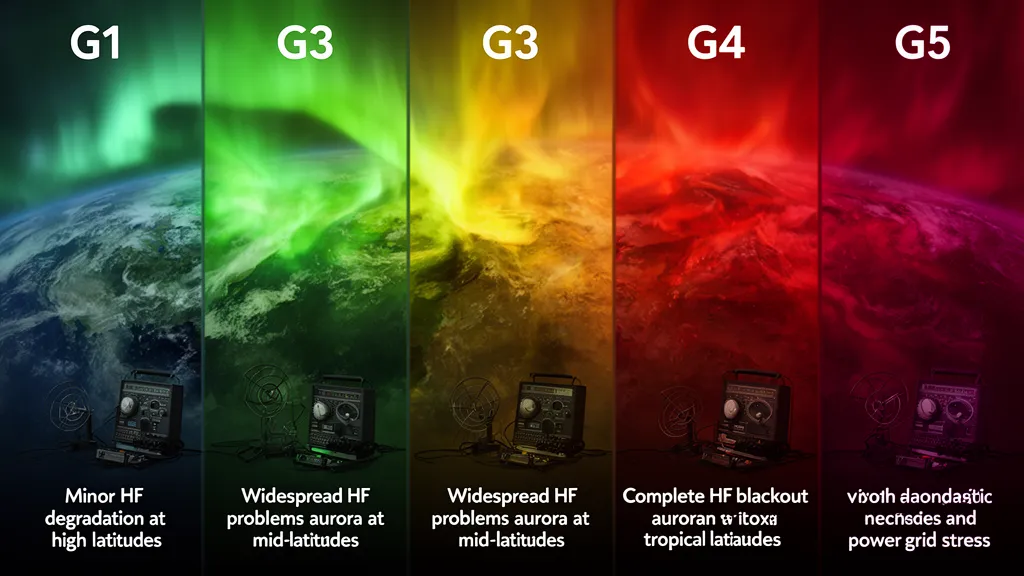
Operator's Verdict: The NOAA G-scale maps geomagnetic storm severity directly to Kp: G1 = Kp 5, G2 = Kp 6, G3 = Kp 7, G4 = Kp 8, G5 = Kp 9. Each step expands the auroral oval equatorward and increases HF absorption on high-latitude paths. G1 affects paths above 60° N; G5 produces near-total HF blackout above 45° N. Check live Kp on DXRadar's solar weather page before any polar-route DX session.
The NOAA G-Scale: What It Measures and Why It Matters
The NOAA Space Weather Scale for geomagnetic storms — the G-scale — maps one-to-one with the Kp (planetary K) index: G1 = Kp 5, G2 = Kp 6, G3 = Kp 7, G4 = Kp 8, G5 = Kp 9. NOAA introduced the scale in 1999 to provide a standardized vocabulary for communicating storm severity to power utilities, satellite operators, and radio users.
Kp itself is a quasi-logarithmic index of geomagnetic disturbance, derived from a global network of 13 magnetic observatories between 44° and 60° geographic latitude and updated every 3 hours. The third-integer subdivisions (5−, 5, 5+, etc.) mean that all qualify as G1, while the round integers define the G-scale thresholds.
The physical mechanism linking Kp to HF degradation is auroral particle precipitation. During a geomagnetic storm, energetic particles injected from the magnetosphere along magnetic field lines bombard the upper atmosphere in an oval-shaped region around the magnetic poles. This precipitation:
- Increases D-layer and E-layer electron density in the auroral zone — both day and night at high latitudes — causing HF absorption by the same collisional mechanism that normally operates only on the dayside
- Disrupts F2 layer structure through Joule heating of the upper atmosphere, changing electron density gradients and producing multipath on signals that penetrate to the F2 layer
- Expands equatorward at higher storm levels — at G5, the oval pushes to 45–50° geomagnetic latitude, bringing storm absorption to paths over Scotland, southern Canada, and the upper continental United States
The absorption is not uniform across HF. Lower frequencies suffer more: 15m and 10m show the greatest relative degradation, while 40m and 80m are more resilient because their longer wavelengths are less susceptible to the electron density enhancement at D/E layer altitudes.
Pro Tip: Monitor DXRadar's solar weather dashboard for real-time space weather data — check it before every operating session.
G1 (Kp 5): Minor Storm — High Latitudes Only
G1 is the most common storm level, occurring approximately 1,700 times per 11-year solar cycle according to NOAA statistics. Effects are real but geographically confined to high-latitude paths.
At Kp 5, the auroral oval expands to approximately 65–70° geomagnetic latitude. HF paths crossing this zone show:
- 15m and above on polar routes: intermittent absorption and multipath; 10–20 dB signal loss
- Trans-polar paths from North America to Europe via the Arctic: intermittent flutter, SSB becomes difficult on the worst paths
- 20m and below at mid-latitudes: essentially unaffected
On the radio at G1: Stations previously worked at S9 on a polar path drop to S5–S6 with a distinctive watery, fluttering quality. SSB becomes difficult; FT8 still completes the contact. The signal doesn't disappear cleanly — it flutters and distorts. That characteristic fingerprint of absorption plus multipath distinguishes a storm-affected path from simply weak propagation.
Aurora becomes visible above approximately 60° N geomagnetic latitude — the latitude of Oslo, Helsinki, and northern Scotland geographically, though exact visibility depends on the oval's shape and local magnetic declination.
Strategy at G1:
- Continue DX on 20m and below without modification
- Treat 15m polar paths as unreliable; switch to FT8 if you want to push through
- Monitor Kp trend: a rising Kp through G1 signals further degradation ahead
- Use DXRadar's live K-index display to watch for peak vs. recovery
G2 (Kp 6): Moderate Storm — Mid-Latitude Paths Start Failing
G2 storms occur roughly 600 times per 11-year cycle. The disturbed zone expands to approximately 55° geomagnetic latitude, affecting paths crossing northern Europe (Scandinavia, Scotland), southern Canada, and the northern tier of the United States.
| Band | G2 Impact |
|---|---|
| 10m | Polar paths unusable; equatorial paths unaffected |
| 15m | Severely degraded to unusable on paths above 55° N |
| 20m | Degradation on polar-route and high-latitude paths; low-latitude OK |
| 40m | Mostly reliable; minor degradation on extreme polar paths |
| 80m | Reliable for regional and equatorial paths |
On the radio at G2: The characteristic sound is rapid amplitude modulation — "polar flutter" at roughly 2–10 Hz. On FT8, decodes that ran at +5 dB SNR drop to −10 dB SNR and become intermittent. A QSO that normally takes 4 transmission sequences requires 8–10. A JA calling CQ on 15m via the polar path disappears mid-over. W6 to KH6 on 20m at low latitude, unaffected. Geographic path selection now matters enormously — a non-polar equatorial path can be excellent while a polar path is unusable simultaneously.
Power grid effects begin at G2 — voltage regulation equipment may experience irregularities. Not a radio concern directly, but a sign the storm is real and impacting infrastructure broadly.
Strategy at G2:
- Focus DX on equatorial or low-latitude paths; these survive G2 intact
- Treat polar-route 15m and 20m as unreliable
- Switch to FT8 if you want to attempt marginal polar paths
- 40m for regional contacts and less sensitive DX paths
G3 (Kp 7): Strong Storm — Widespread HF Degradation
G3 storms occur approximately 200 times per 11-year cycle and mark a significant operational threshold. The disturbed zone expands to approximately 50° geomagnetic latitude, covering central Europe and the central United States in addition to high-latitude regions.
At G3, polar path communication becomes essentially impossible. The scale of degradation:
- 15m and 10m: Unusable on all paths crossing above 45° N geomagnetic latitude
- 20m trans-Atlantic (W1 to DL, UK to JA): significantly degraded; QSOs that previously ran at S9 may drop 20–30 dB
- 20m equatorial paths: degraded but often still functional — W6 to LU, W4 to PY, DL to ZS
- 40m at night: the most reliable band for DX; nighttime 40m avoids D-layer absorption entirely and equatorial paths route well below the storm zone
- 40m NVIS for regional: reliable throughout G3 for paths within 1,500 km
During the Cycle 25 active period, G3 events occurred roughly monthly during the most active intervals of 2024, providing operators repeated experience managing operations under these conditions.
On the radio at G3: 40m SSB produces a characteristic dichotomy — paths within 2,000 km via NVIS are excellent, while DX paths crossing disturbed latitudes show deep, slow fades with 20+ dB variation over 30-second intervals. A JA pile-up that was easy on 15m an hour ago is simply gone. The broadband noise floor may rise noticeably on 10m and 15m due to storm-enhanced ionospheric scatter reaching mid-latitude receiving antennas.
Strategy at G3:
- 40m night is the primary DX band; focus on equatorial and southern-hemisphere paths
- 40m or 80m NVIS for reliable regional contacts
- FT8, JS8Call, and Winlink are critical — digital modes extend the operational window when SSB fails
- Trans-polar and trans-Atlantic DX on 15m and 20m is essentially suspended; do not waste time chasing it
G4 (Kp 8): Severe Storm — HF Blackout on Most Paths
G4 storms occur roughly 100 times per 11-year cycle — less than once per year on average, concentrated near solar maximum. The auroral oval expands to approximately 45° geomagnetic latitude, bringing storm-enhanced absorption to paths traversing central Europe, most of North America, and Japan.
At G4:
- Widespread HF blackout on all paths above 45° N — the entire northern tier of North America and most of Europe
- 20m and below degrade significantly even on equatorial paths as the overall F2 ionosphere is disturbed globally
- 40m nighttime at low latitudes (below 35° N): partial survival; southern US, Caribbean, Mediterranean stations may still contact each other
- 80m NVIS: most reliable HF mode for regional communication during peak
- Aurora visible to ~45° N geomagnetic latitude — Minneapolis, northern France, central Germany
On the radio at G4: 20m sounds dead. Occasionally a signal surfaces — typically a low-latitude path entirely below the disturbed zone — but fades before the QSO completes. 40m from the southern United States or the Mediterranean to other low-latitude stations may produce contacts. Stations above 55° N experience near-complete HF blackout: even high-power stations with large antennas cannot punch through. EMCOMM networks default to VHF/UHF and 80m NVIS.
Recovery from G4 takes 24–48 hours to reach pre-storm ionospheric conditions, with an additional 12–24 hours of irregular F2 structure after Kp drops to normal.
G5 (Kp 9): Extreme Storm — Near-Total HF Blackout
G5 storms are rare — approximately 4 per 11-year solar cycle on average. The most recent was May 10–11, 2024, reaching Kp 9.33. Before that, the previous G5 was the Halloween storm of October 29, 2003 (Kp 9.5), which remains the highest geomagnetic activity recorded since the K-index instrument era.
At G5:
- Near-total HF blackout on all paths crossing above 45° N geographic latitude: essentially all of Europe, Japan, Canada, and the northern contiguous United States
- Equatorial paths on 40m and 20m may partially survive — stations in the Caribbean, Central America, equatorial Africa and Asia may still work each other
- 80m NVIS: the most reliable HF option, providing regional communication within ~500 km
- Aurora visible to 40° N geomagnetic latitude and sometimes lower — during the May 2024 storm, aurora was photographed as far south as Florida and Texas (approximately 30–35° N geographic)
During the October 2003 Halloween storms, North American operators reported 20m completely dead for 36+ hours on all paths. Satellite and VHF/UHF became the only reliable communication options for regional and national EMCOMM coordination. EMCOMM nets that had not exercised their NVIS capability discovered its importance under real-world conditions.
The May 2024 G5 event provided more recent lessons. Operators who maintained operational 80m NVIS antennas provided regional coverage throughout. Those relying solely on 20m for EMCOMM were effectively off the air for the storm duration.
Post-Storm Recovery and Enhancement
The recovery phase is not a linear return to normal. Two effects matter for operators planning their next DX session after a storm.
F2-Layer Recovery (12–48 hours)
As storm energy input decreases and Kp falls below 4, the F2 layer begins rebuilding. The recovery is not smooth — the thermosphere has been significantly heated and disturbed, creating irregular electron density structures that produce more multipath fading and frequency-selective propagation than pre-storm conditions. A Kp 2 reading 24 hours post-storm does not equal pre-storm quality.
Post-Storm Enhancement (24–48 hours after end)
A well-documented phenomenon: approximately 24–48 hours after a significant storm ends, enhanced ionization appears on mid-latitude and low-latitude F2 paths — sometimes surpassing pre-storm conditions. The mechanism involves a storm-enhanced dynamo electric field in the recovery phase that temporarily elevates F2 ionization at low and mid latitudes.
Experienced DXers track this. After a G3 storm, note the storm end time (when Kp drops below 3 consistently) and plan a 20m or 15m DX session approximately 30–36 hours later. The enhancement is empirically reliable and documented in the propagation literature, though its exact timing varies. Use DXRadar's solar weather history to track when Kp peaked and began falling.
Operating Strategy Summary by G Level
| Storm Level | Best Bands | Best Path Types | Avoid | Digital Advantage |
|---|---|---|---|---|
| G1 (Kp 5) | 20m, 40m, 80m | Equatorial, low-latitude DX | 15m polar paths | Moderate — FT8 extends marginal paths |
| G2 (Kp 6) | 40m, 80m | Low-latitude DX, regional | 20m+ polar, 15m everywhere | Significant — FT8 where SSB fails |
| G3 (Kp 7) | 40m night, 80m | Equatorial 20m, 40m NVIS | Trans-polar, trans-Atlantic 15/20m | High — FT8/JS8Call critical |
| G4 (Kp 8) | 80m NVIS, 40m night low-lat | Regional, southern hemisphere | Most HF DX | Very high — digital only viable option |
| G5 (Kp 9) | 80m NVIS, 160m local | Regional within 500 km | All DX; nearly all HF | Highest — only reliable HF mode |
The 40m night rule: 40m at night benefits from the collapse of the D-layer regardless of geomagnetic conditions. Storm-enhanced D-layer absorption is primarily a dayside and high-latitude effect. At night on low-latitude paths, 40m often survives into G3 conditions because the path geometry avoids the auroral oval entirely. This makes nighttime 40m the most reliable DX fallback band through moderate storms.
The NVIS imperative: G3+ conditions are exactly when NVIS communication is most critical — when normal HF DX fails and VHF/UHF distances fall short. An 80m dipole at 10 meters height or a loaded 40m NVIS antenna provides regional coverage (200–1,500 km) through conditions that shut down all long-range HF links. See the propagation modes overview for NVIS setup guidance.
Frequently Asked Questions
What is a G1 geomagnetic storm and how does it affect HF radio?
G1 corresponds to Kp 5. It produces minor HF degradation on high-latitude paths crossing above approximately 60° geomagnetic latitude. Trans-polar routes from North America to Europe or Asia may show intermittent flutter and 10–20 dB absorption on 15m and above. Mid-latitude paths on 20m and below are generally unaffected. G1 is the most common storm level, occurring roughly 1,700 times per 11-year solar cycle.
What Kp level causes HF radio blackout?
Complete HF blackout on polar-route paths typically occurs at Kp 7 (G3) or higher. At Kp 8 (G4), most paths above 50° N are unusable. At Kp 9 (G5), near-total HF blackout occurs on paths poleward of 45° N. Equatorial paths on 40m and 80m retain partial functionality even during G4, and 80m NVIS for regional contacts within 500 km remains viable throughout all storm levels.
How long does a geomagnetic storm last?
G1–G2 storms typically last 6–24 hours. G3 storms persist 12–36 hours. G4–G5 storms driven by large CMEs can last 24–72 hours. Full F2-layer recovery to pre-storm conditions may require an additional 12–24 hours after Kp returns to baseline. The 27-day solar rotation period can produce recurrent storms from the same coronal hole, so a second storm may arrive before full recovery from the first.
Is there a propagation improvement after a geomagnetic storm?
Yes — a post-storm F2 enhancement frequently occurs 24–48 hours after a significant storm ends. The mechanism is a storm-enhanced equatorial electric field during the recovery phase that temporarily increases mid-latitude F2 ionization. Equatorial and low-latitude paths on 20m and 15m can show elevated MUF during this window. Experienced DXers plan sessions around 30–36 hours post-storm to exploit this effect.
When was the last G5 geomagnetic storm?
The most recent G5 storm occurred on May 10–11, 2024, reaching maximum Kp 9.33. It was driven by multiple large CMEs from a highly active region and produced aurora visible to 40° N geographic latitude and lower across North America and Europe. The previous G5 was the Halloween storm of October 29, 2003 (Kp 9.5), which remains the most intense single storm interval since the K-index instrument era began.
What does geomagnetic storm absorption sound like on HF?
The on-air signature is a watery, fluttering quality on received signals — rapid amplitude modulation at 2–10 Hz, quite distinct from the slow, deep fading of ordinary multipath. A formerly strong signal from Europe on 15m sounds distorted and garbled rather than simply weak. On FT8, signal-to-noise ratios drop and decodes become intermittent. FT8 is typically the last mode to fail on a storm-degraded path.
How does geomagnetic latitude differ from geographic latitude?
Geomagnetic latitude is measured relative to Earth's geomagnetic poles, not geographic poles. The geomagnetic north pole is currently located near 80° N, 72° W in northern Canada — meaning geomagnetic 60° N corresponds roughly to geographic 50°–65° N depending on longitude. Northern Europe (UK, Scandinavia) sits at higher geomagnetic latitudes than the same geographic latitudes in North America, making European high-latitude paths more susceptible to storm absorption than equivalent geographic-latitude paths in the western hemisphere.